

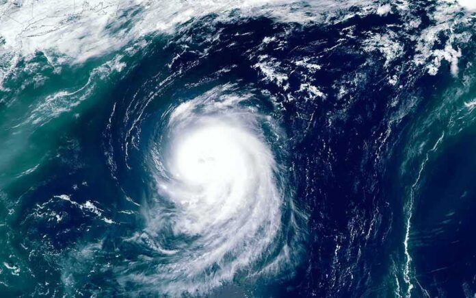
A very severe cyclonic storm slammed into India’s east coast with winds up to 135 km/h, then weakened inland the same day.
Story Snapshot
- India’s weather agency confirmed landfall along Andhra Pradesh and Yanam near Narsapur on October 28.
- Maximum sustained winds ranged from 125 to 135 km/h, with gusts up to 150 km/h during landfall.
- NASA reported sustained winds near 130 km/h and landfall in the early hours of October 28.
- The storm weakened to a deep depression by late October 28 as it moved inland.
Landfall Location And Timing Confirmed By Officials
India’s meteorological authority reported that Cyclone Arnab crossed the Andhra Pradesh and Yanam coasts near Narsapur between 2:00 a.m. and 8:00 a.m. local time on October 28. Officials placed the crossing between the cities of Bapatla and Visakhapatnam, about 20 kilometers east-northeast of Narsapur. The release included the center’s coordinates near 16.45 degrees north and 81.90 degrees east. These details align with a planned forecast window issued the prior day that warned of an early October 28 landfall.
NASA’s Earth Observatory echoed the landfall report and cited sustained winds of about 130 kilometers per hour when the storm came ashore in the early hours of October 28. NASA’s summary fits within India’s official range for maximum sustained wind speed at landfall. The match across agencies supports the core facts: where Arnab hit, the rough timing, and the order of magnitude of the winds that reached the coast that morning.
Wind Intensity And Gusts At The Coast
The India Meteorological Department stated that maximum sustained winds reached 125 to 135 kilometers per hour, with gusts up to 150 kilometers per hour during landfall. That range captures the strength people felt on the coast and helps explain reports of heavy rain and power disruptions in broadcast coverage. The government’s release also used standard definitions that separate sustained winds from brief, stronger gusts during squalls, which often cause the worst damage at the surface.
A regional tropical cyclone advisory issued later on October 28 remained consistent with those figures. It described the system’s intensity and movement through the landfall period and into the day. This consistency matters because different outlets sometimes quote a single rounded value, while the operational record keeps a range. Here, the advisory and the press releases point to the same story: a very severe cyclonic storm at the coast that lost strength over land as expected.
Rapid Inland Weakening And The Path After Landfall
By late evening on October 28, India’s weather agency reported that Arnab had weakened into a deep depression over parts of north coastal Andhra Pradesh and nearby areas of Odisha, Chhattisgarh, and Telangana. The downgrade came as the storm’s core moved fully over land and lost the ocean heat that fuels strong winds. The agency’s late bulletin marked the end of the most dangerous wind phase and the start of a rain and flooding risk inland.
Cyclone Arnab Landfall: Andhra Pradesh on High Alert 🌪️🚨
Cyclone Arnab made landfall near Narsapur, Andhra Pradesh early this morning as a very severe cyclonic storm with sustained winds of 125–135 km/h and gusts up to 150 km/h. #CycloneArnab #AndhraPradesh #IMDAlert #StaySafe pic.twitter.com/vfCf6q4qSW
— Madhav Mehta (@MadhavMeht21) October 29, 2026
The Ministry of Earth Sciences confirmed that the landfall process finished by 8:00 a.m. local time, once the storm’s central region moved completely over land. That matches the weakening trend observed through the day and helps explain why the focus shifted to rainfall, river levels, and landslide risks in hilly terrain. Forecast offices often stress this transition so local officials can move resources from coastal wind safety to inland flood response.
Why Reporting Can Differ Without Disputing The Facts
Different agencies often report the same storm with slightly different numbers or times because they serve different needs. India’s weather service uses ranges for sustained winds and notes gusts. NASA often rounds to a simple figure to aid public understanding. Broadcasters may quote the first strong conditions as “landfall,” while forecasters define landfall as the center crossing the shoreline. Those differences can confuse viewers even when everyone agrees on the main event.
Why This Matters For Readers In The United States
Storm communication is a universal challenge. When numbers vary, people can doubt warnings and delay action. That delay costs lives, whether on India’s Bay of Bengal or America’s Gulf Coast. Clean, consistent messages help families know when to evacuate, where to find power updates, and how long hazards will last. Clear ranges for wind and rain, plus plain timing, reduce noise and help people act faster when minutes matter most.
Sources:
science.nasa.gov, mausam.imd.gov.in, internal.imd.gov.in
© patriotspotlight.org 2026. All rights reserved.